Ardestan County
Ardestan County (Persian: شهرستان اردستان) is in Isfahan province, Iran. Its capital is the city of Ardestan.[3]
Ardestan County
Persian: شهرستان اردستان | |
|---|---|
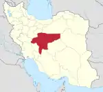
 Location of Ardestan County in Isfahan province (top right, yellow) | |
 Location of Isfahan province in Iran | |
| Coordinates: 33°38′N 52°21′E[1] | |
| Country | |
| Province | Isfahan |
| Capital | Ardestan |
| Districts | Central, Mahabad, Zavareh |
| Population (2016)[2] | |
| • Total | 42,105 |
| Time zone | UTC+3:30 (IRST) |
| Ardestan County can be found at GEOnet Names Server, at this link, by opening the Advanced Search box, entering "9205973" in the "Unique Feature Id" form, and clicking on "Search Database". | |
Demographics
Population
At the time of the 2006 National Census, the county's population was 43,585 in 12,587 households.[4] The following census in 2011 counted 41,405 people in 12,930 households.[5] At the 2016 census, the county's population was 42,105 in 14,140 households.[2]
In April of 2023, Garmsir and Hombarat Rural Districts, and the city of Mahabad were separated from the Central District in the establishment of Mahabad District, with the city as its capital.[6]
Administrative divisions
Ardestan County's population history and administrative structure over three consecutive censuses are shown in the following table.
| Administrative Divisions | 2006[4] | 2011[5] | 2016[2] |
|---|---|---|---|
| Central District | 30,838 | 29,011 | 29,427 |
| Barzavand RD | 3,943 | 2,937 | 2,972 |
| Garmsir RD | 3,781 | 3,388 | 3,218 |
| Hombarat RD | 728 | 554 | 830 |
| Kachu RD | 1,771 | 1,295 | 1,483 |
| Olya RD | 1,836 | 1,480 | 1,453 |
| Ardestan (city) | 14,698 | 15,701 | 15,744 |
| Mahabad (city) | 4,081 | 3,656 | 3,727 |
| Mahabad District[lower-alpha 1] | |||
| Garmsir RD | |||
| Hombarat RD | |||
| Mahabad (city) | |||
| Zavareh District | 12,747 | 12,394 | 12,678 |
| Rigestan RD | 4,157 | 4,040 | 3,953 |
| Sofla RD | 784 | 540 | 405 |
| Zavareh (city) | 7,806 | 7,814 | 8,320 |
| Total | 43,585 | 41,405 | 42,105 |
| RD = Rural District | |||
Notes
- Established after the 2016 census[6]
References
- OpenStreetMap contributors (8 June 2023). "Ardestan County" (Map). OpenStreetMap. Retrieved 8 June 2023.
- "Census of the Islamic Republic of Iran, 1395 (2016)". AMAR (in Persian). The Statistical Center of Iran. p. 10. Archived from the original (Excel) on 19 October 2020. Retrieved 19 December 2022.
- Habibi, Hassan (21 June 1369). "Approval of the organization and chain of citizenship of the elements and units of the national divisions of Isfahan province, centered in the city of Isfahan". Lamtakam (in Persian). Ministry of Interior, Defense Political Commission of the Government Board. Archived from the original on 4 February 2024. Retrieved 4 February 2024.
- "Census of the Islamic Republic of Iran, 1385 (2006)". AMAR (in Persian). The Statistical Center of Iran. p. 10. Archived from the original (Excel) on 20 September 2011. Retrieved 25 September 2022.
- "Census of the Islamic Republic of Iran, 1390 (2011)". Syracuse University (in Persian). The Statistical Center of Iran. p. 10. Archived from the original (Excel) on 17 January 2023. Retrieved 19 December 2022.
- "Approval letter regarding country divisions in Isfahan province". RRK (in Persian). 3 April 2023. Archived from the original on 22 April 2023. Retrieved 8 June 2023.
Isfahan province, Iran | |||||||||||||||||||||||||||||||||||||||||||||||||
|---|---|---|---|---|---|---|---|---|---|---|---|---|---|---|---|---|---|---|---|---|---|---|---|---|---|---|---|---|---|---|---|---|---|---|---|---|---|---|---|---|---|---|---|---|---|---|---|---|---|
| Capital |
|  | |||||||||||||||||||||||||||||||||||||||||||||||
| Counties and cities |
| ||||||||||||||||||||||||||||||||||||||||||||||||
| Sights |
| ||||||||||||||||||||||||||||||||||||||||||||||||
| See also |
| ||||||||||||||||||||||||||||||||||||||||||||||||
| Capital |
| ||||||||||||||||
|---|---|---|---|---|---|---|---|---|---|---|---|---|---|---|---|---|---|
| Districts |
| ||||||||||||||||
This article is issued from Wikipedia. The text is licensed under Creative Commons - Attribution - Sharealike. Additional terms may apply for the media files.