Ferdows County
Ferdows County (Persian: شهرستان فردوس) is in South Khorasan province, Iran. Its capital is the city of Ferdows.[3]
Ferdows County
Persian: شهرستان فردوس | |
|---|---|
 Location of Ferdows County in South Khorasan province (top, pink) | |
 Location of South Khorasan province in Iran | |
| Coordinates: 33°51′N 58°01′E[1] | |
| Country | |
| Province | South Khorasan |
| Capital | Ferdows |
| Districts | Central, Eslamiyeh |
| Population (2016)[2] | |
| • Total | 45,523 |
| Time zone | UTC+3:30 (IRST) |
| Ferdows County at GEOnet Names Server | |
History
Situated in the north of the province, Ferdows County, which was formed in 1944, originally included a large area (more than 78,000 km2), but its subdivisions have gradually become independent and now encompasses four counties (Ferdows, Tabas, Sarayan and Boshruyeh counties). After dividing the former Khorasan province into three provinces, Ferdows County was initially a part of Razavi Khorasan province, but was incorporated within the borders of South Khorasan province in March 2007.
Demographics
Population
At the time of the 2006 National Census, the county's population was 61,346 in 17,539 households.[4] The following census in 2011 counted 41,626 people in 12,440 households,[5] by which time Boshruyeh District had been separated from the county in the establishment of Boshruyeh County.[6] At the 2016 census, the county's population was 45,523 in 14,302 households.[2]
In May 2020, Baghestan Rural District, Borun Rural District, and the city of Eslamiyeh were separated from the Central District in the establishment of Eslamiyeh District, which was divided into two rural districts and the city. At the same time, the village of Baghestan-e Olya was elevated to the status of the city of Baghestan.[7]
Administrative divisions
Ferdows County's population history and administrative structure over three consecutive censuses are shown in the following table.
| Administrative Divisions | 2006[4] | 2011[5] | 2016[2] |
|---|---|---|---|
| Central District | 38,301 | 41,626 | 45,523 |
| Baghestan RD | 5,395 | 5,361 | 5,438 |
| Borun RD | 2,048 | 1,835 | 1,721 |
| Howmeh RD | 2,286 | 2,378 | 2,561 |
| Eslamiyeh (city) | 5,167 | 6,084 | 7,108 |
| Ferdows (city) | 23,405 | 25,968 | 28,695 |
| Boshruyeh District[lower-alpha 1] | 23,045 | ||
| Ali Jamal RD | 3,612 | ||
| Eresk RD | 3,226 | ||
| Raqqeh RD | 2,429 | ||
| Boshruyeh (city) | 13,778 | ||
| Eslamiyeh District[lower-alpha 2] | |||
| Baghestan RD | |||
| Borun RD | |||
| Baghestan (city)[lower-alpha 3] | |||
| Eslamiyeh (city) | |||
| Total | 61,346 | 41,626 | 45,523 |
| RD = Rural District | |||
Geography
Ferdows County borders Gonabad County and Bajestan County to the north, Gonabad County and Sarayan County to the east, Boshruyeh County to the west and south, and Tabas County to the south.
Agriculture
Ferdows is famous for its high quality saffron and pomegranate.
Visitor attractions
- Ferdows Hot Mineral Spring
- Ferdows Hole-in-the-Rock
- Polond Desert
- Ferdows Religious School (dating to Safavid dynasty)
- Ferdows Congregation Mosque (Jame' Mosque of Ferdows) (dating to Seljuk dynasty)
Notes
- Transferred to Boshruyeh County[6]
- Established after the 2016 census[7]
- Became a city after the 2016 census[7]
References
- OpenStreetMap contributors (20 March 2023). "Ferdows County" (Map). OpenStreetMap. Retrieved 20 March 2023.
- "Census of the Islamic Republic of Iran, 1395 (2016)". AMAR (in Persian). The Statistical Center of Iran. p. 29. Archived from the original (Excel) on 17 October 2020. Retrieved 19 December 2022.
- Habibi, Hassan (21 June 1369). "Approval of the organization and chain of citizenship of the elements and units of the divisions of Khorasan province, centered in Mashhad". Lamtakam (in Persian). Ministry of Interior, Defense Political Commission of the Government Council. Archived from the original on 27 December 2023. Retrieved 27 December 2023.
- "Census of the Islamic Republic of Iran, 1385 (2006)". AMAR (in Persian). The Statistical Center of Iran. p. 29. Archived from the original (Excel) on 20 September 2011. Retrieved 25 September 2022.
- "Census of the Islamic Republic of Iran, 1390 (2011)". Syracuse University (in Persian). The Statistical Center of Iran. p. 29. Archived from the original (Excel) on 20 January 2023. Retrieved 19 December 2022.
- "Boshruyeh District was upgraded to a county". Fars News (in Persian). Ministry of Interior, Cabinet of Ministers. 12 November 2008. Archived from the original on 10 November 2023. Retrieved 10 November 2023.
- Jahangiri, Ishaq (20 May 2020). "Letter of approval regarding country divisions in Ferdows County of South Khorasan province". Islamic Parliament Research Center of the Islamic Republic of Iran (in Persian). Ministry of Interior, Board of Ministers. Archived from the original on 3 June 2020. Retrieved 19 March 2023.
South Khorasan Province, Iran | |||||||||||||||||||||||
|---|---|---|---|---|---|---|---|---|---|---|---|---|---|---|---|---|---|---|---|---|---|---|---|
| Capital |   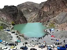 | ||||||||||||||||||||||
| Counties and cities |
| ||||||||||||||||||||||
| Sights |
| ||||||||||||||||||||||
| Populated places |
| ||||||||||||||||||||||
| Capital | |||||||||||||||||||
|---|---|---|---|---|---|---|---|---|---|---|---|---|---|---|---|---|---|---|---|
| Districts |
| ||||||||||||||||||